Navionics Plus Chart Plotter North Md: MSD/NAV+NO
Navionics + North Regions Gives Maximun Detailed Cartography For Cruising,Fishing and Sailing
Features:
- Lake charts
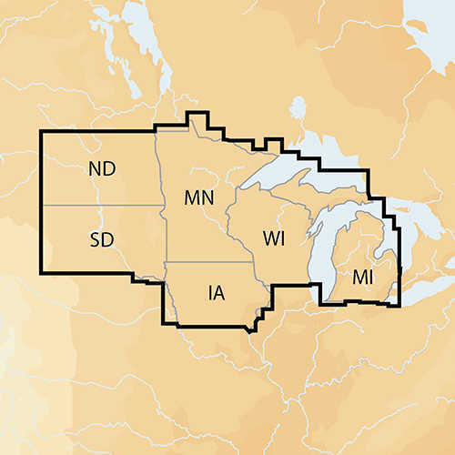
- 7,400 lakes and growing in IA, MI, MN, ND, SD, and WI, plus all of Lake of the Woods, Rainy Lake and US waters of the region’s Great Lakes.
- Plug and play: Preloaded card with both Nautical Chart and SonarChart
- View detailed shorelines with marinas, docks and boat ramp locations.
- Increase your awareness of shallow waters and hazardous areas at any depth level including shoals, rocks, wrecks and more.
- Target underwater structure with up to 1 ft HD contours to find the best fishing locations: roadbeds, foundations, bridges, brush piles, culverts and creek channels.
- Consult tides and currents to plan your boating activities.
- Download Community Edits, valuable local information added by millions of Navionics Boating app users.
- Get the most current charts every day with daily updates for one year.